|
Sanborn maps were created around America in over 12,000 communities from 1867-2007. The name comes from the company that created them - The Sanborn Company of New York. They were primarily made as a tool to assess for potential fire insurance risks and related information for insurance companies. Should they insure properties, and, if so, at what cost and risk? The map would help them make a decision.
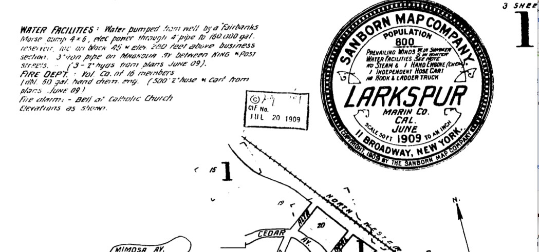
What's really great about these old maps is they always had a brief description of the water supply available for fire protection, and of any fire department or resources. We know they were done for at least 11 communities in Marin County, and we hope to eventually post most of them. For now, check out the full sample map from Larkspur in 1909 on the Sanborn Fire Maps page. A closeup of the top of the page is shown below, describing the water supply, population, and fire department. Comments are closed.
|
AuthorOur Blog announces new site content, and gives the context of the topic and it's relationship to fire service history. Written by Bill Lellis & Paul Smith Archives
August 2022
Categories |

 RSS Feed